China has become a major manufacturing base for Industrial UAV systems serving energy, construction, agriculture, surveying, and public infrastructure. Global buyers now expect more than competitive pricing. They need dependable flight control, accurate payload integration, secure data handling, and responsive technical support.
Grand View Research estimated the global commercial drone market at approximately US$30 billion in 2023. Its report also projected strong growth through 2030. Drone Industry Insights has similarly identified inspection, mapping, and logistics as important commercial applications. However, these figures use different market definitions. That matters. Industrial UAV sales are not always reported separately from consumer or defense-related systems. A careful comparison should therefore examine product specifications, field performance, certifications, and service capacity rather than headline revenue alone.
“The drone is not the product; the data is the product,” said Brandon Torres Declet, a recognized commercial-drone industry executive. His observation remains practical for global procurement teams. A thermal camera is valuable only when it produces reliable images. A long-endurance platform is useful only when operators can maintain it safely. In factory evaluations, buyers should inspect battery cycle records, wind-resistance claims, spare-parts availability, software updates, and repair procedures. Small details matter.
Some manufacturers communicate these capabilities clearly. Others rely on impressive demonstrations that do not represent daily operations. That gap deserves attention. This guide compares leading Chinese Industrial UAV manufacturers through an evidence-based lens, including engineering experience, manufacturing consistency, export readiness, compliance awareness, and after-sales support. No supplier is perfect. The strongest choice depends on the mission, operating environment, budget, and the buyer’s willingness to verify every claim.
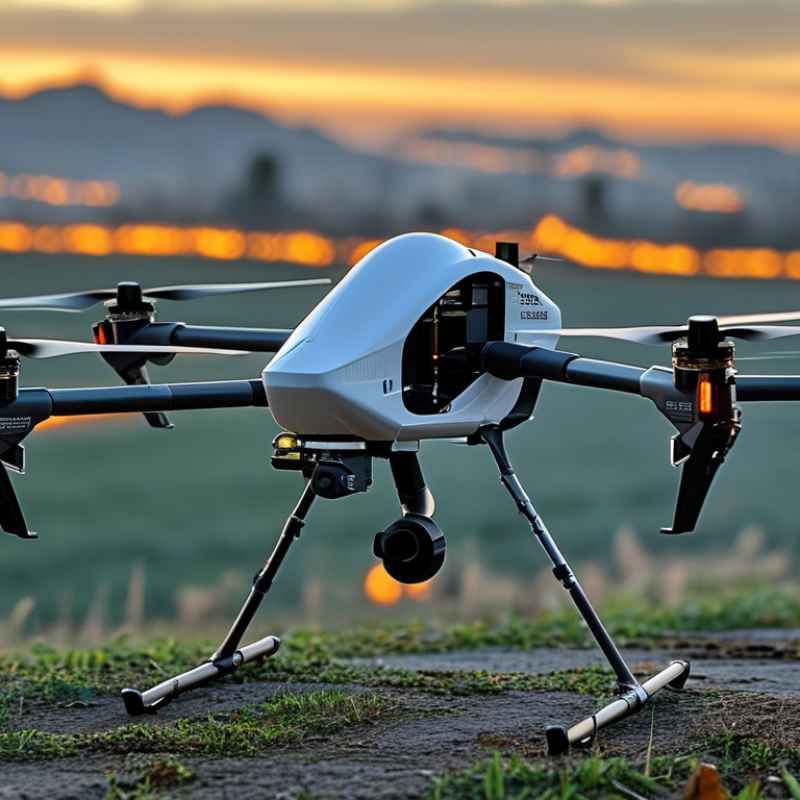
China’s industrial UAV market reached a significant scale in 2023. The Civil Aviation Administration of China (CAAC) reported approximately 1.27 million registered civil drones nationwide. This figure includes equipment used for surveying, agriculture, logistics support, inspection, and emergency services. It shows strong domestic demand, but registration numbers alone do not prove manufacturing quality.
The CAAC’s 2023 Civil Aviation Industry Development Statistical Bulletin also recorded rapid growth in drone operations and supporting services. For global buyers, this expansion suggests deeper supplier experience in flight control, payload integration, battery management, and maintenance planning. The real question is operational reliability. Can a supplier provide repeatable testing records, traceable components, and clear technical documentation?
Look beyond the catalog.
A serious procurement review should examine production capacity, environmental testing, data security procedures, pilot training, and after-sales response. International market studies, including reports from Drone Industry Insights, also identify inspection, mapping, and public-service applications as major commercial demand areas. However, forecasts can be optimistic. Some suppliers may present impressive endurance figures under ideal conditions, while real flights involve wind, dust, temperature changes, and payload variation. Buyers should request independent test results and conduct field trials before placing large orders. Supplier claims need evidence.
China’s industrial UAV sector serves inspection, mapping, agriculture, and emergency response. Global buyers should compare payload, endurance, and flight range separately. These specifications describe different operating advantages.
Small multirotors often carry 2–5 kilograms for cameras, thermal sensors, or LiDAR. Heavy-lift platforms can exceed 20 kilograms, but their flight time usually decreases. Fixed-wing systems commonly provide over 100 kilometers of range under suitable conditions. Hybrid aircraft may offer longer endurance, often between two and eight hours. Actual results depend on wind, battery temperature, payload weight, and flight altitude. Drone Industry Insights’ Drone Market Report 2024 projects strong commercial UAV growth through 2030. MarketsandMarkets also reports double-digit annual growth expectations for the broader UAV market. These figures support continued demand, but they do not guarantee project-level savings.
Tips: Ask for measured flight logs, not brochure claims. Request payload tests with your exact sensor package. Check battery cycle data, spare-part availability, training, and maintenance response times. Confirm whether range means radio distance or total route distance. A spreadsheet can still mislead. Chinese suppliers may offer competitive engineering and production capacity, yet quality consistency can vary between batches. Independent factory audits, sample flights, and documented acceptance tests remain essential for reliable global procurement.
Industrial UAV performance is commonly assessed by payload capacity, endurance, and operating range. The chart below presents representative published specification values for common industrial UAV configurations, without identifying any company or brand.
Heavy-lift multirotors typically provide the highest payload capacity, while fixed-wing and hybrid VTOL configurations generally deliver longer endurance and flight range. Actual performance depends on battery or fuel configuration, weather, altitude, payload, and regulatory limits.
Industrial UAV buyers need capabilities matched to real operating conditions, not impressive brochures. Enterprise camera platforms support inspections, mapping, emergency assessment, and infrastructure surveys. They usually offer stabilized imaging, thermal sensors, obstacle avoidance, and encrypted data workflows. A field team can inspect a bridge joint while standing safely below it.
Enterprise camera platforms support inspections, mapping, emergency assessment, and infrastructure surveys. They usually offer stabilized imaging, thermal sensors, obstacle avoidance, and encrypted data workflows. A field team can inspect a bridge joint while standing safely below it.
Agricultural UAVs focus on precision spraying, spreading, and crop monitoring. Their value depends on tank capacity, terrain following, route planning, and accurate application control.
Heavy industrial VTOL systems serve longer-range mapping and repeated missions. They may combine fixed-wing endurance with vertical takeoff, which helps on restricted sites.
Tethered UAVs provide persistent aerial observation and continuous power near events, facilities, or temporary work zones. However, endurance claims can change sharply in wind, cold weather, or heavy payload conditions. No platform is perfect.
Tips:
Check payload performance, battery cycles, controller range, weather limits, repair access, and local aviation requirements. Request a live demonstration with your own camera or workflow. Review sample outputs, not only flight time. Train operators on setup, recovery, and data security. A low purchase price may become expensive after spare parts, software fees, and downtime. Procurement teams should also test whether the aircraft integrates with existing mapping, inspection, and asset-management systems. Minor compatibility problems often become major delays.
China Top Industrial UAV Manufacturers for Global Buyers?
Industrial UAVs are becoming practical tools for mapping, agriculture, inspection, and emergency response. For global buyers, capable manufacturers should provide more than aircraft and cameras. They need stable flight systems, clear maintenance records, trained technical teams, and reliable software updates. Field experience matters. A minor calibration error can distort a complete survey.
In mapping projects, UAVs capture overlapping images of roads, mines, and construction sites. Accurate positioning reduces repeated flights and costly delays. Agricultural models can inspect crop color, moisture patterns, and irrigation gaps. However, weather changes quickly, so one flight plan may not suit every field. Operators should test results against ground observations. Perfect data is rare.
Inspection teams use thermal and high-resolution cameras to examine roofs, power structures, storage tanks, and bridges. A safe distance protects both equipment and workers. During floods or earthquakes, emergency UAVs can locate blocked roads and deliver visual information to response teams. These missions require approved airspace, trained pilots, secure data handling, and documented operating procedures. Buyers should also ask about spare parts, battery life, repair times, and local support. Some manufacturers promise too much. Careful verification remains necessary.
| Industrial UAV Application | Typical UAV Configuration | Common Sensors or Payloads | Typical Endurance | Representative Operating Data | Primary Deliverables | Important Buyer Requirements |
|---|---|---|---|---|---|---|
| Aerial Mapping and Surveying | Multirotor for small sites or fixed-wing VTOL for larger areas; RTK/PPK positioning preferred. | High-resolution RGB camera, multispectral camera, LiDAR, or oblique camera system. | Approximately 30–60 minutes for multirotors; commonly 60–120 minutes for fixed-wing VTOL platforms. | Ground sampling distance of about 1–5 cm is common for low-altitude photogrammetry; daily coverage depends on altitude, overlap, terrain, and processing workflow. | Orthomosaics, digital elevation models, 3D point clouds, contour maps, volumetric calculations, and progress reports. | RTK/PPK accuracy, camera calibration, terrain-following capability, waypoint planning, data-security controls, and compatibility with common mapping software. |
| Precision Agriculture | Multirotor survey UAV or agricultural spraying UAV with interchangeable batteries and modular tanks. | RGB, multispectral, thermal, spraying system, spreading system, terrain radar, and obstacle sensors. | Approximately 20–45 minutes for survey missions; spraying platforms typically operate in shorter flight cycles because of payload weight. | Agricultural spraying UAVs commonly use liquid tanks in the approximate 10–50 L range; practical field productivity varies with crop, terrain, refill time, and local regulations. | Crop vigor maps, plant-count estimates, stress detection, variable-rate application plans, spraying records, and field scouting reports. | Flow-rate control, droplet-size adjustment, terrain following, safe chemical handling, washability, spare-battery availability, and agricultural-use certification. |
| Infrastructure Inspection | Stable multirotor with precision hovering, obstacle avoidance, and optional tethered operation for extended missions. | 4K or higher RGB camera, optical zoom, thermal camera, LiDAR, and laser rangefinder. | Approximately 25–55 minutes, depending on payload, wind, and operating distance. | Typical targets include bridges, towers, solar farms, wind turbines, pipelines, roofs, and power corridors; thermal surveys require controlled flight parameters and suitable temperature differences. | Geotagged photos, thermal anomaly reports, corrosion or crack documentation, inspection models, maintenance priorities, and asset-condition databases. | Optical zoom quality, image stabilization, low-light performance, wind resistance, collision avoidance, encrypted transmission, and repeatable flight plans. |
| Emergency Response and Public Safety | Rapid-deployment multirotor, heavy-lift multirotor, fixed-wing VTOL, or tethered UAV for persistent observation. | Thermal camera, low-light camera, spotlight, loudspeaker, searchlight, mapping camera, and communication relay payload. | Approximately 20–45 minutes for battery-powered multirotors; tethered systems can support much longer stationary operations. | Rapid-deployment systems are generally selected for launch within minutes, reliable control links, night operation, and continued operation in moderate wind and light precipitation. | Live situational awareness, victim-location coordinates, fire or flood maps, damage assessments, public-address communication, and incident video records. | Fast setup, encrypted communications, thermal imaging, reliable return-to-home behavior, redundant positioning, high-visibility lighting, and local public-safety approvals. |
| Mining and Quarry Surveying | RTK-enabled multirotor for stockpiles and open pits; fixed-wing VTOL for extensive mining areas. | RGB photogrammetry camera, LiDAR, multispectral camera, and laser altimeter. | Approximately 30–120 minutes, depending on aircraft type and survey objectives. | Repeated surveys can support stockpile volume calculations, pit-wall monitoring, haul-road mapping, and comparison of earthwork progress over time. | Volume reports, terrain models, cut-and-fill calculations, slope maps, progress measurements, and safety documentation. | Survey-grade positioning, dust resistance, strong wind performance, geofencing, safe operation near machinery, and integration with CAD or GIS platforms. |
| Power-Line and Energy Inspection | Long-endurance multirotor or fixed-wing VTOL with automated corridor flight capability. | High-resolution zoom camera, thermal camera, ultraviolet camera, LiDAR, and positioning sensors. | Approximately 30–90 minutes for common battery-powered configurations. | Inspection missions focus on conductors, insulators, towers, substations, solar modules, and wind-turbine components while maintaining safe separation distances. | Defect images, thermal hotspots, asset coordinates, vegetation-clearance records, defect classifications, and maintenance recommendations. | Electromagnetic-environment performance, accurate positioning, zoom stabilization, automated obstacle avoidance, secure data storage, and utility-workflow integration. |
| Global Buyer Evaluation Criteria | Select the airframe according to mission area, payload weight, required endurance, terrain, weather, and regulatory category. | Confirm sensor specifications, payload interfaces, replaceable components, battery system, and software capabilities. | Compare rated endurance with mission endurance under real payload and weather conditions. | Review maximum takeoff mass, payload capacity, wind tolerance, operating temperature, IP rating, control range, and communication-link redundancy. | Require exportable raw data, standard file formats, mission logs, API availability, operator training, and clear maintenance documentation. | Check country-specific aviation rules, radio approvals, privacy requirements, cybersecurity policies, warranty terms, spare parts, technical support, and total cost of ownership. |
A global buyer should treat BVLOS capability as a regulatory project, not a product feature. The FAA’s Aerospace Forecast FY2024–2044 projects continued growth in commercial small-UAS operations, but operating approval remains separate from aircraft purchase. EASA also requires risk-based operational authorization for many higher-risk missions.
Ask for documented command-link performance, detect-and-avoid plans, remote-pilot training, and country-specific approval support. Marketing claims are not evidence.
MTOW affects registration, operating categories, transport, and insurance. Request an empty-weight and maximum-payload table, including batteries and mission equipment.
A 25-kilogram aircraft can face different requirements from a 24.9-kilogram aircraft. That small difference matters.
For outdoor work, verify the IP rating under IEC 60529. IP54 indicates limited dust protection and water splashes; it does not guarantee operation in heavy rain. Test reports should identify the exact configuration, test laboratory, and date.
After-sales support deserves measurable terms. Drone Industry Insights has repeatedly identified service and reliability as major commercial-market concerns in its annual drone market reports.
Require spare-parts lead times, repair turnaround, firmware support, battery-cycle guidance, and local training. Ask for a failure-escalation process.
A two-year warranty may sound strong, yet downtime can still exceed its value. I would also request field references from similar climates and workloads.
One weakness remains easy to miss: many buyers compare flight time, but overlook charging infrastructure, replacement batteries, and data-security procedures.
Vs commonly used for?
Small multirotors often carry two to five kilograms. Heavy-lift aircraft may exceed 20 kilograms. More weight usually means shorter flight time.
Endurance measures time in the air. Range may mean radio distance or total route distance. Ask suppliers to define both terms clearly.
Wind, cold batteries, heavy sensors, and high altitude can reduce performance. A perfect brochure number is unlikely.
Request measured flight logs and payload tests with your exact sensor package. Review battery cycles, sample flights, and acceptance records. Real data matters more.
Mapping missions may use cameras, thermal sensors, or LiDAR. Agricultural flights can examine crop color, moisture patterns, and irrigation gaps. Ground checks should confirm the results.
High-resolution and thermal cameras can examine roofs, bridges, tanks, and power structures. During floods, UAVs may show blocked roads quickly. Safety still comes first.
Look for trained technicians, spare parts, software updates, and clear repair times. Check maintenance records and local support options. Promises alone are weak evidence.
Conduct independent factory audits and sample flights. Confirm airspace approval, pilot training, data security, and operating procedures. Quality may vary between production batches. That deserves honest attention.
China’s Industrial UAV market has expanded rapidly, with 1.27 million civil drones registered in 2023, reflecting strong growth in commercial and public-service applications. Chinese manufacturers now offer a broad range of platforms differentiated by payload capacity, flight endurance, operating range, navigation systems, and automation features. These aircraft support professional tasks such as aerial mapping, precision agriculture, infrastructure inspection, environmental monitoring, and emergency response, helping organizations improve efficiency, data quality, and operational safety.
For global buyers, selecting an Industrial UAV requires more than comparing specifications. Important considerations include maximum takeoff weight, battery and charging performance, wind resistance, weather protection, payload compatibility, data security, and the ability to operate under applicable BVLOS requirements. Buyers should also evaluate training, maintenance, spare-parts availability, software integration, warranty terms, and local after-sales support. A careful assessment of mission needs, operating conditions, and service resources can help ensure reliable long-term deployment.

UUUFLY
